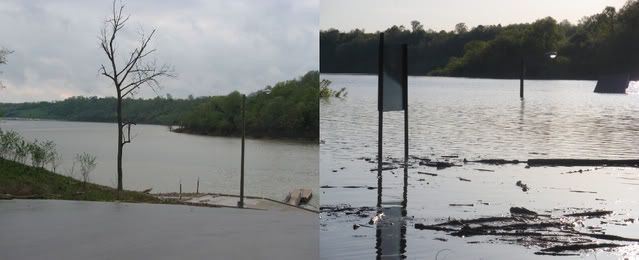
Picture from Taylorsville lake 35 ft above summer pool.
Moderators: E_, LC addict, FasterThanYou, crwky
- Sunset Lady
- SUPER Member
- Posts: 681
- Joined: Thu Apr 22, 2010 12:44 pm
- Location: Kentucky
Picture from Taylorsville lake 35 ft above summer pool.
Normal.................................................. Flooded
- Sunset Lady
- SUPER Member
- Posts: 681
- Joined: Thu Apr 22, 2010 12:44 pm
- Location: Kentucky
Re: Picture from Taylorsville lake 35 ft above summer pool.
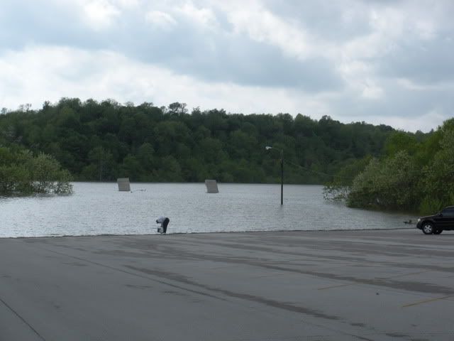
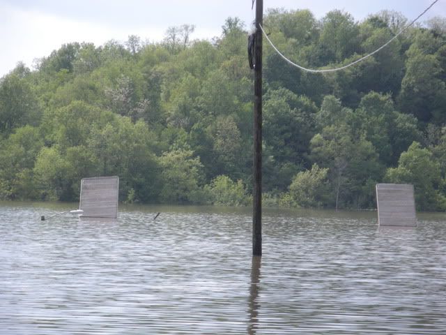
Here are a few more pictures taken 5/3 from Taylorsville lake. The lake is at a record high level
of 40 feet above summer pool.
Same area from my previous post.
of 40 feet above summer pool.
Same area from my previous post.
- FasterThanYou
- MASTER MEMBER
- Posts: 2068
- Joined: Sat Oct 25, 2008 4:22 pm
- Marina/Ramp: Woodson Bend
- Location: Lake Cumberland
- Contact:
Re: Picture from Taylorsville lake 35 ft above summer pool.
Looks nasty. ___ sent me this one the other day and meant to post it already.
- Attachments
-
- Photo0600.jpg (275.23 KiB) Viewed 1434 times
Keyboards should be equipped with breathalyzers
- E_
- Site Admin
- Posts: 14818
- Joined: Fri Oct 24, 2008 10:26 pm
- Marina/Ramp: Currently mostly out of Jamestown but spend a lot of time at the other Marinas.
Pre2012-Conley Bottom Mostly, Waitsboro, Alligator I&II ramps, Leesford, Pulaski County Park (when it has water), Grider, State Dock (via boat), and Jamestown are a few places you might find me. - Location: Kentucky (Lake Cumberland)
- Contact:
Re: Picture from Taylorsville lake 35 ft above summer pool.
GEWWWWWWWWWWW!
Buy American, the job you save just might be your own.
- Sunset Lady
- SUPER Member
- Posts: 681
- Joined: Thu Apr 22, 2010 12:44 pm
- Location: Kentucky
Re: Picture from Taylorsville lake 35 ft above summer pool.
Thanks ___ for the Marina photo, I was curious about the water level there.
- Sunset Lady
- SUPER Member
- Posts: 681
- Joined: Thu Apr 22, 2010 12:44 pm
- Location: Kentucky
Re: Picture from Taylorsville lake 35 ft above summer pool.
(WHAS11)- Record rainfall is taxing the lake system designed to prevent flood disasters in Kentuckiana.
Taylorsville Lake, about 45 miles southeast of Louisville, is the latest reservoir to reach capacity, recording a record high full pool of 592 feet on Wednesday.
"Every day, this prolonged series of storms that keep coming day after day after day are not allowing us time to put water out of the lakes," said Col. Keith Landry, commander of the U.S. Army Corps of Engineers Louisville District.
"It just means we have less and less capacity to handle additional rain. At some point, we've got to start getting a break. Otherwise, we'll have no capacity in some of our lakes," said Landry.
Taylorsville Lake acts as a huge catch basin of the Salt River, with a conduit out of the dam controlling the flow of water into the river in order to protect lives and property in downstream communities such as Taylorsville, Shepherdsville and West Point and into the Ohio River.
For the first time in the manmade lake's 28-year history, the water is so high it is now draining into an emergency spillway, where the Corps cannot control the volume of water fed to the Salt River. As of Wednesday afternoon, the spillway water had not reached the Salt River, yet heavy rains could trigger that possibility.
In Taylorsville, levees hold back the Salt River on side of the city and Brashear's Creek, which feeds into Salt Creek, on the other. City officials say when the creek is fed by torrential rainfall, the swollen waters back up into the Salt River. In a worst case scenario, the backed up Salt River would be fed simultaneously by water from Taylorsville Lake.
Though Taylorsville officials are optimistic that the weather forecast does not include enough rainfall to present that threat, the city is preparing.
"We readied ourselves in just emergency preparation with sandbags and sand in case that scenario should play out," said Gary Kehne, Flood Wall Commissioner.
About 25 miles downstream in Shepherdsville, Salt River floodwaters have still not completely receded from last week's flooding. A large pool of water blocks Joe B. Hall Avenue one block from the river. Yet, Mayor Scott Ellis (R) is thankful that Taylorsville Lake has held back what could be devastating floodwater.
"My concern is that if we get any more rain on top of anything that comes out of the lake, we may have some issues," Ellis said.
http://www.whas11.com/news/local/Record ... 91029.html